FREE Freight transport data

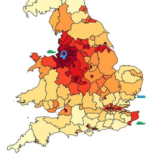
The data available for FREE via the Freight Data Hub is baseline data from the Great Britain Freight Model (GBFM) showing HGV journeys for each Local Authority area.

This model, which incorporates both baseline data and forecasting capability, has been used by the Department for Transport for its freight modelling since 2005.

    The free data provides the volume of HGVs to and from the area, the number and floor space of large warehouses in the area and the top 3 unitload ports serving the area. The heat map shows the origins and destinations of road freight from and to the area.

    To view all - please login.

  • Cheshire West & Chester
  • North Somerset

Cheshire West & Chester

Annual HGV journeys with an origin or destination in the area: 8.87 million
Number of large-scale warehouses (>9,000 m2) in the area: 16
Total large-scale warehouse (>9,000 m2) space in the area: 423,000 m2
Top 3 (ranked) unitised ports serving the area:
  1. Dover (16,000)
  2. Felixstowe (13,000)
  3. Liverpool (12,000)


North Somerset

Annual HGV journeys with an origin or destination in the area: 2.85 million
Number of large-scale warehouses (>9,000 m2) in the area: 5
Total large-scale warehouse (>9,000 m2) space in the area: 91,000 m2
Top 3 (ranked) unitised ports serving the area:
  1. Dover (10,000)
  2. Eurotunnel Shuttle (7,000)
  3. Felixstowe (5,000)